 Adventuriety
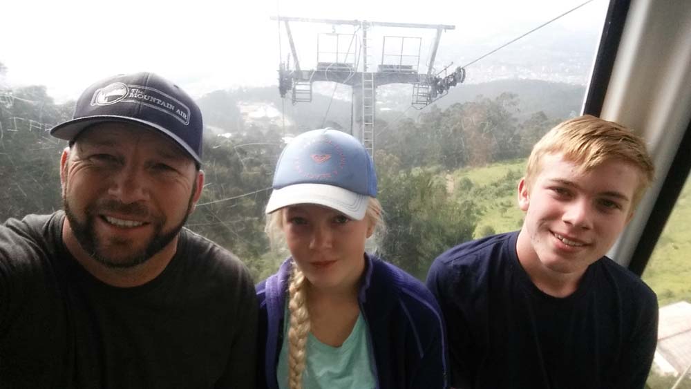
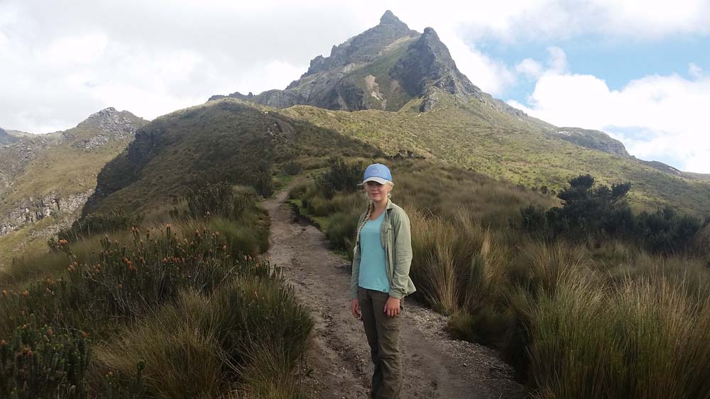
Today we woke up early and shared Special-K and Granola with a few bananas. After a double-check of the backpack, Grant, Ashley and I headed out of our apartment and hailed a taxi. In Quito there are a wide variety of “taxis” so you have to use a little caution to get the ones that are licensed. Always grab the ones that have a solid orange license plate and a green registration sticker in the window. We found such a cab fairly quickly and headed to Teleferiqo. This is a cable-car that takes people and products up and down the side of Pichincha Volcano to lookout Cruz Loma which is at an elevation just shy of 13,000 feet.
All fresh and ready to go
From there, we began our trek to Guaga Pichincha, the farther of two summits on the volcano. We had a short discussion the previous night about which summit to attempt and chose the crater rim of Guagua Pichincha because it is an active volcano and is known to smell of sulfur and to be emitting steam and gases since its last large eruption in 1999.
The first 2 km
We started up the trail at a rhythmic pace. Knowing that climbing at altitude requires discipline, we decided to walk without break for the first 2 kilometers. At the store last night we gathered trail snacks of nuts and raisins, snickers, plantain chips and bought Arabian flat bread with tuna salad for lunch. At our first stop we decided to have two mini Snickers each. The trail to that point was straight forward and just meandered toward the first peak of the volcano known as Ruka Pichincha.
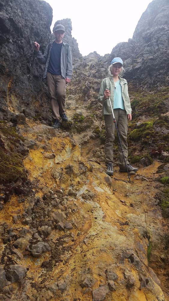
The base of the sandy crumble
the far side of saddle #1
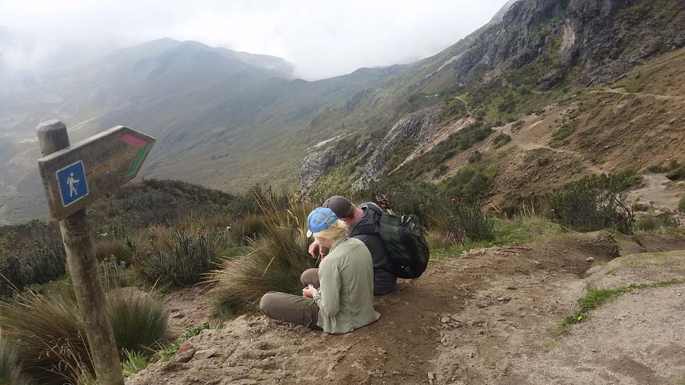
It was a good feeling when the meadow trail gave way to the mountain and we began to round the base of Ruka. The trail was not as steep, at first, and the rock was beautiful and decorated with some plants that looked like ocean coral. At about 4 km, we began our ascent to the first of two saddles we would need to cross and then cross again on the way back. This is where the hiking became, for the first time, quite difficult as the trail disappeared due to years of erosion. There were sign posts that acted like cairns and we were left self-navigating a very steep section of sand-like ash and crumble to the 15,200 foot saddle high above. Do we head straight up? Do we create switchbacks? To we head to the rocks and climb there instead? After some trial and error, Grant blazed us a pretty good trail to saddle #1. As we gasped over the saddle we had traveled about 5.5 km of the 20 km that would be required to see the volcano and end up safely back at the cable car. We struggled down the even steeper, but not quite as loose, backside of saddle #1, stopped for another few snickers and then headed into the middle section of the hike which was a traverse across a beautiful hillside to another saddle. At this point we had been on the trail about 3 hours and were becoming more impressed by the difficulty of the hike. Ashley was planning for the hike to take her mind off her missing mother, but found that as the trail became longer she missed her more. We stopped and chatted and I told the kids we were about a third of the way done with the hike and that we shouldn’t hike much farther away and should set a turn-around limit for 1:30. At that point we could assess where we were and they could make a decision about returning. This precipitated many periodic questions about just exactly what time it was.
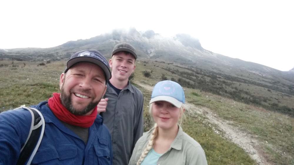
The weather was nice on our way to Guaga Pichincha and around 1:15 we were at the base of the peak that was on the edge of the massive crater where we intended to get our view of black rocks and escaping gasses. At this point we were about 9 km into our hike and had been on the trail about 4 1/2 hours. We began to hear some distant thunder and were shaken when a very loud clap of thunder and rumble filled the sky from the direction of the VOLCANO which at this point was only a kilometer away. It was 1:30 and time for the congenial debate on whether to continue up 500 more slippery feet with an impending storm around us. Did we want to push on, adding another hour to our already 9 hour commitment? Were the clouds going to allow us a view if we did push on? During our conversation we pressed on toward our goal which began to look more doable, but ultimately thought turning around at that point would be a good decision. I was beginning to become more concerned with weather, Ashley was willing but shaken from the distance and Grant said “Sometimes it’s an accomplishment to not need to accomplish something.” We took some photos of Guagua Pichincha, made a U-turn and began our march back to the cable-car.
Posing with Guagua Pichincha
I really liked Grant’s words about accomplishment, but there was plenty for us to accomplish before we would be in bed safe and warm that night.
We enjoyed the hike back to saddle #2, feeling the relief that were heading back and had a good grasp of the trail that lie ahead. Our first couple kilometers back were beautiful with rolling dark clouds over volcanic rock peaks and green valleys. The thunder kept us company and kept me a bit worried. The night before, I was sure to include plenty of warm layers, hats, gloves and rain gear in our bags along with water and snacks. It began to precipitate what I thought was rain, but instead was hail. We hiked for a while and since the hail was frozen we did not get wet until it really started to pick up.
For the next 45 minutes there was “Hail on the Trail!” as I have heard my Dad declare before. The mountain began to look more and more like a white Christmas. Our footing became a bit unstable and even with our extra layers and rain gear, we began to cool off. This entire section of the hike was between easy saddle #2 and killer saddle #1. Not only were the conditions beautifully miserable, but we knew the hardest section lay ahead.
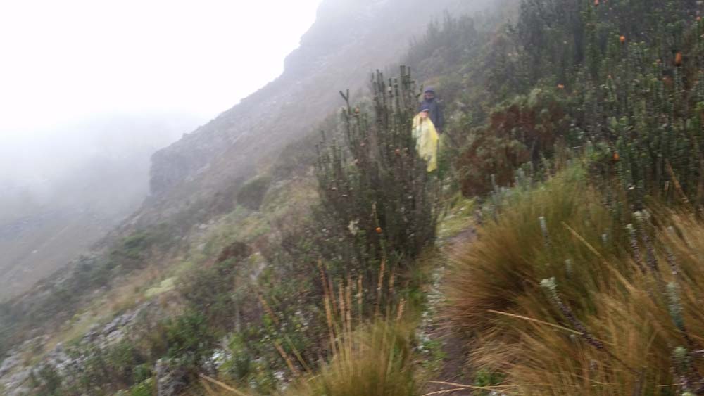
Hail on the trail! Between saddle #2 and #1
Saddle #1. Just a few hours earlier we had felt triumphant crossing the rocky portal. Now we had to make our way back up in our tired, cold and wet state, not to mention the breath-stealing elevation. We paused for a few more mini-snickers and began what was the most challenging ascent I have had in decades, along with what was the hardest hour Grant and Ashley have ever had on the trail.
Top of grind!
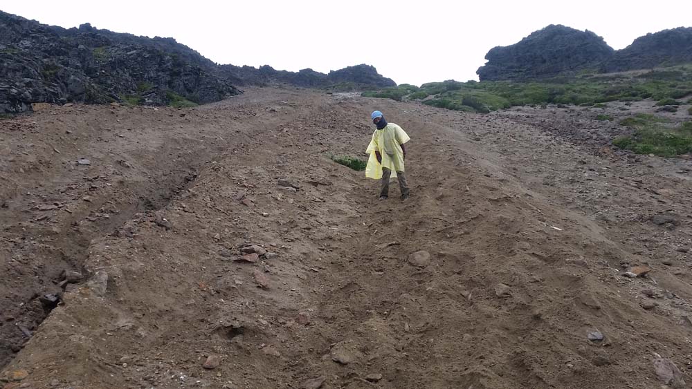
Sandy descent.
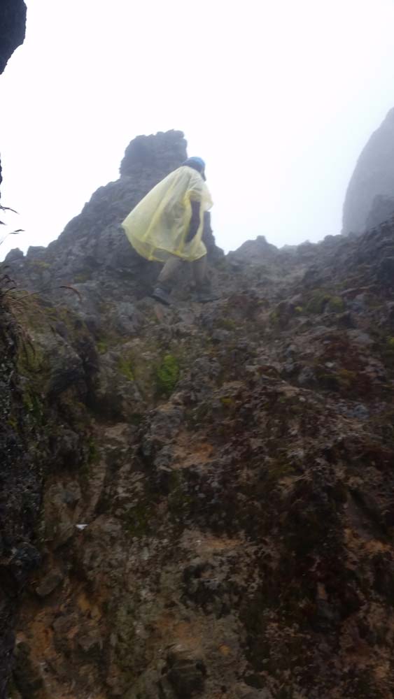
This steep ascent required careful navigation and a technique called the rest-step. We were in a thick fog and knew that the saddle was more or less up but could not see the top which may have been a psychological benefit. As long as we moved vertically we would be wedged into the saddle by the surrounding rock formations. The goal then was to create a route that helped to conserve energy and will power. The footing was loose, wet and the hillside wanted to fall apart as you made your way across it. We found a pair of gullies that had larger rocks that could support our weight and act as stairs. Only occasionally did they dislodge. This felt like a better choice than the looser material that would rob you a half-step with every attempt. Secondly, we teamed up to sync our breathing with our footwork. It is a meditative challenge as you commit to a breath with each step, or sometimes two breaths with each step. The going is slow this way and some mountaineers will spend a dozen or more breaths before moving another foot. Even though we moved up that crumbling slope slowly, we would get there tired, but without exhaustion. This was our toughest hour of all time.
Finally we made it to the sandy side of saddle #1 where we were able to descend 700 feet in the loose sand. It felt like skiing and our spirits lifted as we knew the last hour and a half would be easier. We paused for a snack under a rocky overhang and shared some sighs of relief and grinning faces about what we had just accomplished. We thanked God for giving us the hail before the saddle, the rain after and the calm foggy during. Our conversation down the rest of the trail turned to the plants, the landmarks we would pass and the Chili’s restaurant near our apartment in Quito.
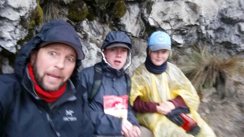
The snack selfie…all in “perfect” health.
We ended our day with a burrito at the Teleferiqo Deli followed by a dark cable car ride down, shuttle, taxi, Chili’s mac down and a great sense of accomplishment. It was a wonderful day of beautiful misery and it will be unforgettable. I love my kids and I am blessed to have shared such a day with them.